Pequonnock River Trail Extension
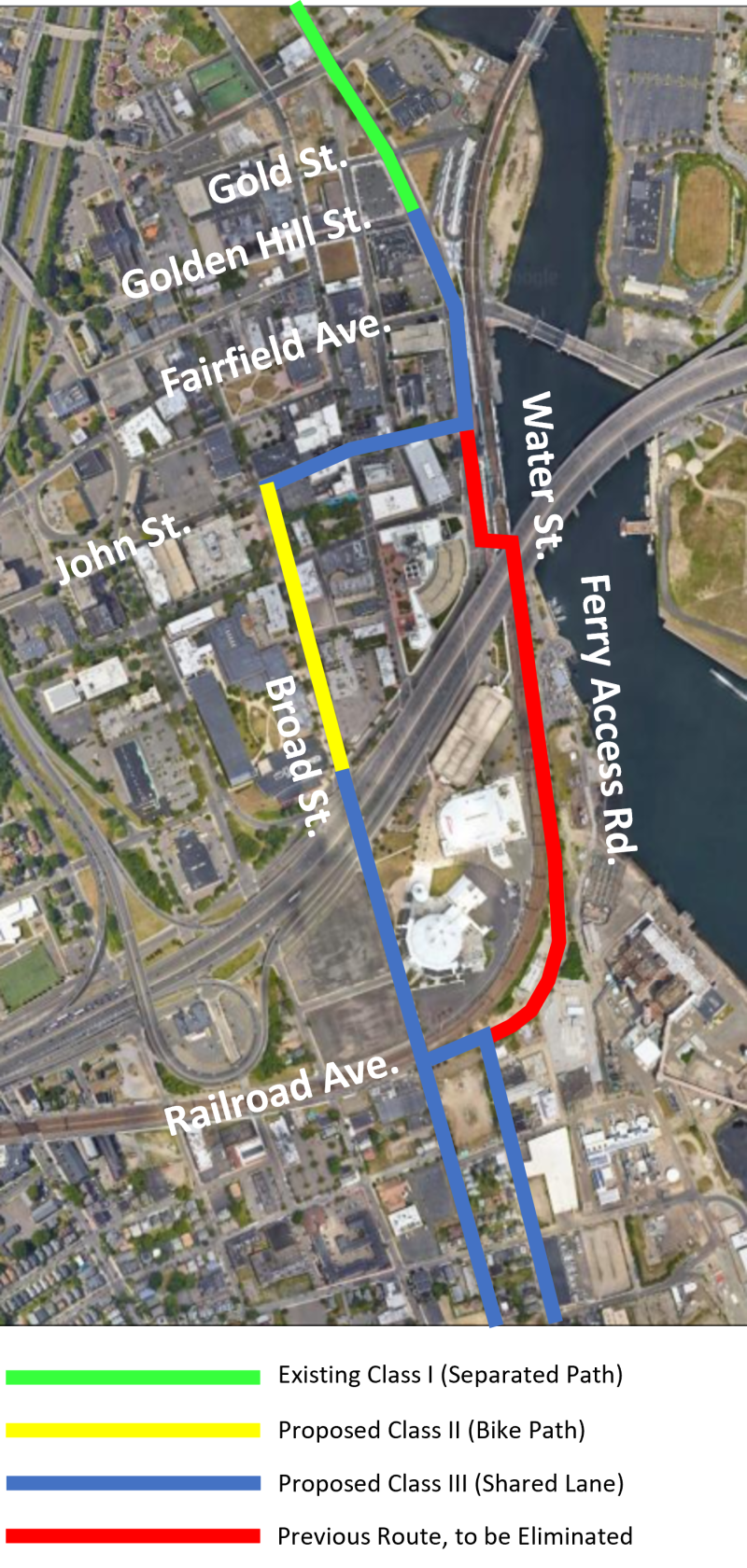
The original Trail alignment had the trail going south down Water Street, under the railroad tracks onto Waterfront Dock, continuing south along Ferry Access Boulevard, and connecting to Broad Street to continue south to Seaside Park.
The Alternate Route removes the Ferry Access Boulevard segment and instead diverts from Water Street to go west along John Street, then south on Broad Street to Seaside Park. The Alternate Route will be shared lane (Class III) along John Street and along Broad Street south of North Frontage Road, and a separated bike lane (Class II) on Broad Street between John Street and North Frontage Road.
The City has received $1,451,760 in Federal Congestion Mitigation and Air Quality Program (CMAQ) funds to design and construct the Pequonnock River Trail (PRT) extension from Beardsley Park to Seaside Park.
The PRT extension will provide improved pathways and help reduce congestion in the downtown area by improving access to public transportation modes, downtown attractions and municipal parks.
The city of Bridgeport and the Towns of Monroe and Trumbull have been working on implementing the regional Pequonnock River Trail since 1992. The goal is to connect segments of existing trails to create a continuous greenway from Long Island Sound and Downtown Bridgeport, through Trumbull and Monroe, to the Newtown town line. Once completed, the Pequonnock River Trail (PRT) will extend approximately 16.2 miles.

See more information about PRT Extension meetings and studies below:
Pequonnock River Trail - Extension Alignment Study
Pequonnock River Trail - Public Information Presentation, September 2018
